
This is our collection of Architectural Webtools to help with Architectural Design Process.
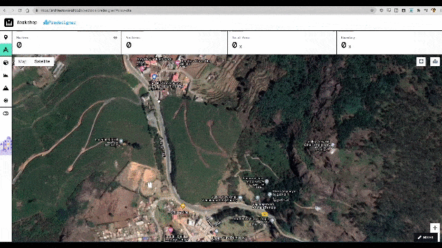
Draw the Architectural Site you wish to Analyze on Predesigner
You can Mark and Edit the boundaries and get the Area and Boundary length, of the Architectural site you want to analyze. You draw directly on a Satellite Image, or on a Stylized Map. Site can be as small as you want, up to as large as a 1000 Acres!
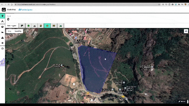
Mark Important Points
You can use Unlimited Markers of different types, Mark all the Points of Interest, or roads and paths as a series of markers to understand the terrain and placement. You can also switch markers on and off in layers, by type, to declutter the Map.
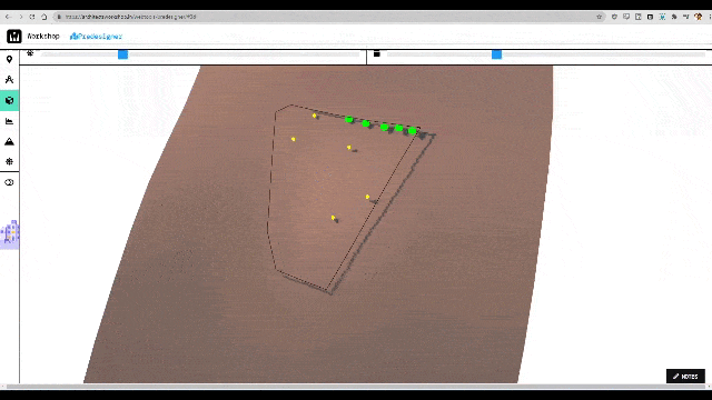
3D Visualization of the Architectural Site Analysis on Predesigner
View your Terrain, the boundary and Points of Interest marked in 3D on Predesigner! As soon as you’ve drawn your site. Fly around your site and view it from any angle to get your perfect perspective (at 60 fps!)
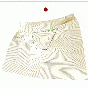
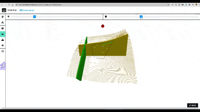
Site Sections through the terrain
Make Site Sections of your site in two directions, just by using the sliders, on PreDesigner, for easy Architectural Site Analysis. Easy as pie. You can get all the parallel sections of the site, showing the slopes and angles clearly.
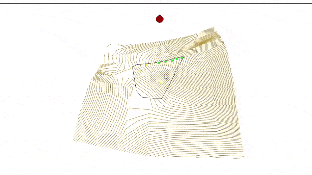
Contours of the full site and surroundings.
Get the contour drawing of your site immediately on drawing it, for any site on earth. Look at the Contour model in 3D to get a better understanding of your site.
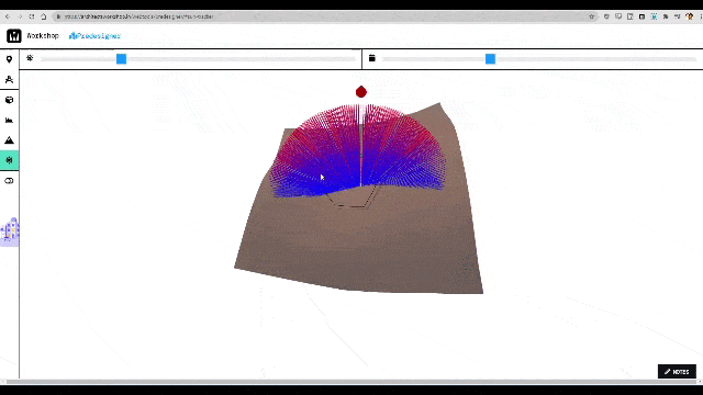
Sun Path – Architectural Site Analysis
You can use the sliders to vary the accurate Sun position (and shadows) by Date and Time, for any time you want to see, in 3D. Get the Sun Path of your site Immediately, as soon as it’s drawn. The exact angles are calculated and marked every six minutes for the entire day, for the full year
Multiple Architectural Sites for Analysis on Predesigner
You can create more then one site, for Architectural Site Analysis on Predesigner! This allows you to compare different locations, or just work on more than one project at a time, as all of us do. (All stored in your browser). You can fully Manage your collection of sites by naming, copying, editing or deleting old sites. It even has a recycle bin.
Auto Save
All your work is autosaved at every keystroke and click, even if you close the browser. Once you reopen the browser, you can go back to the site, and find all your previous work right as you left them. (This is all stored in your browser.
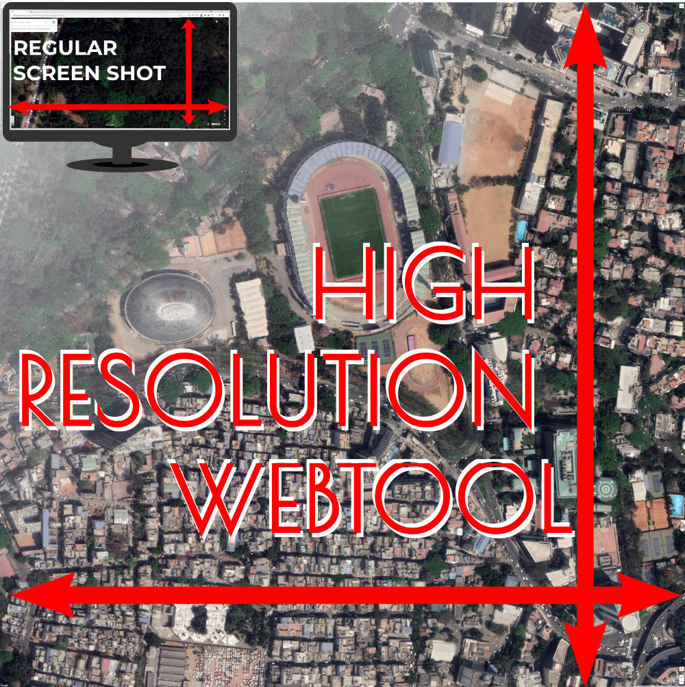
Get a 6000 pixel X 6000 pixel (36 megapixel) High Resolution Google Satellite Image, with no labels, and download it on to your machine to play with as you see fit. This tool removes all the labels, and gives you a clean aerial/satellite photo of the site, allowing you to draw on it in your presentations.
Satellite Images are very useful to understand the site, even just as an aerial photograph of the intended site. While Google Maps allows us to view the maps on their platform, trying using the same images for our presentations are tedious. There is unfortunately no way to download a map, other than to take screen shots of the screen, and try to stitch them together. And all the while trying to remove the names of all the unimportant markers around, from small cafes to malls cluttering up the image. Not to mention the zoom level affecting them and making it one more step in drudgery.
All we ever wanted was an aerial photo, with no names or labels for our presentations. This tool allows just that.
Features of the High Resolution Satellite Image Tool:
- This webtool allows you to capture a very high resolution Google Satellite Map Images directly from the browser.
- Get a 6000 pixel X 6000 pixel (36 megapixel) High Resolution Google Satellite Image, and download it on to your machine to play with.
- That’s a 1 meter by 1 meter when printed at 150 DPI, bigger than an A1 sized sheet. (very nearly A0). 150 DPI is the regular raster image printing resolution for Architectural Drawings,
- It gives you HIGH RESOLUTION IMAGE as a SINGLE image. No more do you have to stitch various screenshots on image editing software. You can now get one massive image, to use directly into your sheets.
- This tool removes all the labels, and gives you a clean image of your Architectural site; allowing you to insert either directly into your sheets.